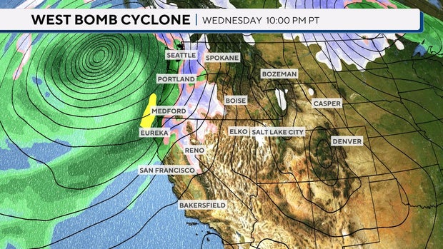
The Northwest is bracing for a strong storm system to move in this week, delivering gusty winds, heavy rain and mountain snow. The National Weather Service says this is the first major storm of the season. An atmospheric river and bomb cyclone are what make this storm so powerful — but what do those terms mean?
What is an atmospheric river?
Atmospheric rivers are no strangers to the western U.S., especially during the fall and winter months. Atmospheric rivers, or “ARs,” are elongated, narrow regions of moisture that travel outside of the tropical regions.
CBS News
They are responsible for producing heavy rain and snow, especially when pushed up against mountain ranges like the Cascades and Sierra Nevada. A well-known type of atmospheric river is called a “Pineapple Express” because it flows from the Hawaiian Islands.
Strong ARs transport water vapor roughly equivalent to 7.5 to 15 times the average flow of the Mississippi River. Annually, 30% to 50% of the West Coast’s precipitation occurs with just a few atmospheric river events.
What is a bomb cyclone?
Bomb cyclones are low pressure systems that undergo what meteorologists call “bombogenesis.” Bombogenesis occurs when a midlatitude cyclone (“midlatitude” meaning the area between the tropics and the polar regions) rapidly intensifies over a 24-hour period.
CBS News
In most regions, if the atmospheric pressure drops at least 24 millibars within 24 hours, it is considered a bomb cyclone.
Bomb cyclones can occur when a cold air mass collides with a warm air mass, which is how some significant winter storms can happen.
When an atmospheric river and bomb cyclone occur at the same time, a major weather event is expected. Atmospheric rivers provide the moisture, and the bomb cyclone provides the intensity and increased winds.
The major event this week has rainfall totals upwards of 10-20 inches in some spots. Mountain snow totals are expected to be over a foot in most areas; higher elevations could receive upwards of 2 to 3 feet.


